Trail Description
The CamRock Trail System has a little something for everyone. Scenery and wildlife along the creeks, fast and fun berms, oak savannahs, and prairie sections. Everything from flat tight twisty trails, berms and rollers, fast and flowy sections, to sketchy rock sections. It is all singletrack with some great views and feels like you are deep in the woods, though you are never far from the gravel connector trail.
The trails run from Cambridge to Rockdale, with a place for a beverage and a bite to eat at each end. A quick exit is easily accessible if needed for a mechanical or other emergency. Trails are well marked with maps at all the main intersections and markers along the trail. If you have an emergency note the marker code (C10, H7, etc.) for quick emergency response.
A Dane County trail pass is required.
Beginner to advanced trails. Well-marked with maps at intersections. Interconnected loop system with wooded singletrack and some open and flowing sections. About 11 miles depending how you count the mileage. Some loops repeat parts of trail sections.
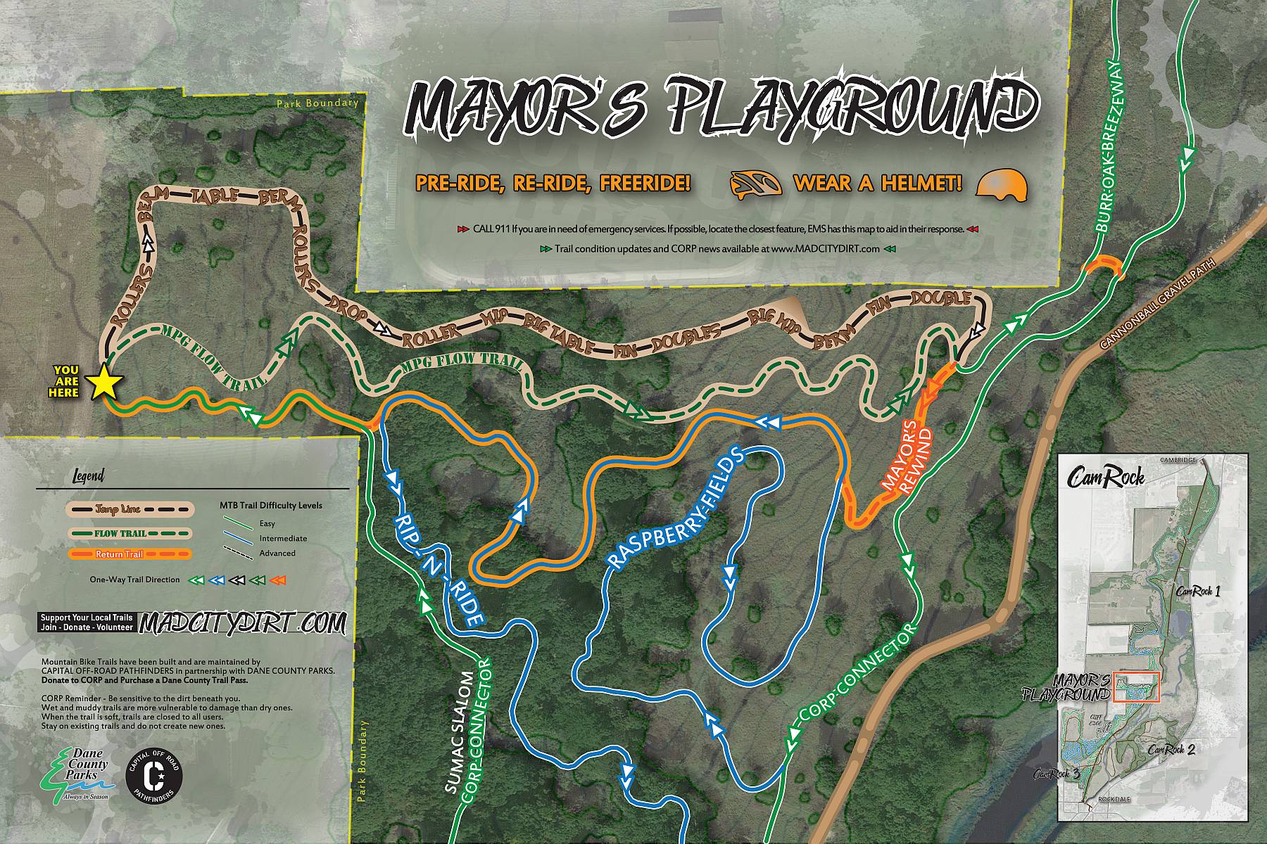
Check out the jumps and stuff in the Mayor's Playground.

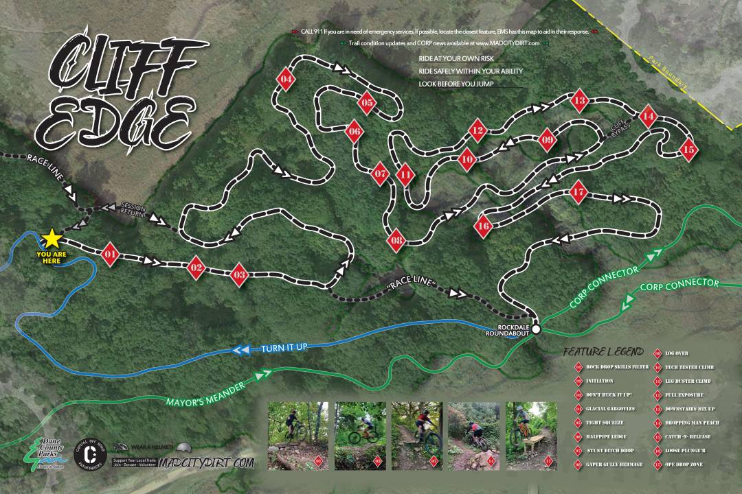
Folks looking for an extra challenge should visit the Cliff Edge trails.

Questions or Concerns?
Chuck Hutchens - Trail Steward
David Reece - Assistant Trail Steward